
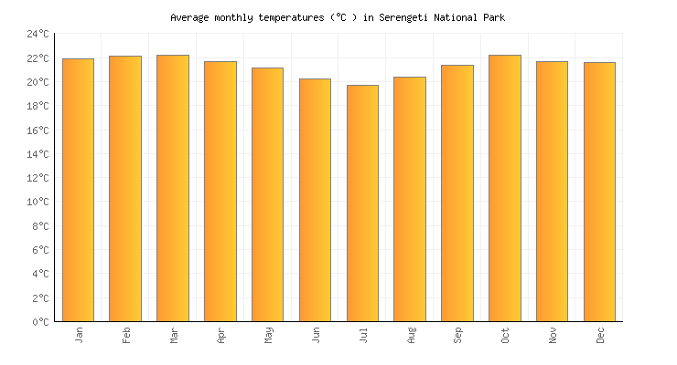
Temperatures
The Serengeti has a very pleasant and moderate temperature, unlike the popular belief that Africa is a very hot place (2). The wet seasons are the warmest as temperatures vary with the seasons (2). In the Seronera, the the temperature rare exceeds 37 °C on a hot afternoon in the rainy season and hardly ever dips below 13 °C on a cold early morning in the dry season (2). Regardless, temperatures during the dat are uncomfortably hot and drop dramatically during the night (2). With elevation, the average daily temperatures vary from 15°C near the crater highlands.to 30°C near Lake Victoria (3). This altitude makes the Serengeti a “cooler Island” in warmer regions (3).
Rainfall Periods
The Serengeti National Park has two rainy seasons, as you can see below, November and December are the first to break the grip from dry climate (4). The long rains take place from March to May right after which makes the rainfall the highest these months (4). The rainfall occurs most days, making the season the ‘green season’ because of the landscape turning green from the rainfall (4). Sometimes the rainfall fuses in their patterns in specific regions, for instance, short rains may form together in the southeast of the Serengeti, and the rains can fuse into one extended period in the north (4). Nonetheless, the rain is unpredictable and likely to interfere with your tour! (4)

Rainfall Gradient
From the dry southeast plains (400 mm per year) to the much wetter northwest near the Kenyan border and the Masai Mara (up to 1,200 mm per year) there is a rainfall gradient (5). The rain shadow of the Ngorongoro Crater Area and the Meru-Kilimanjaro mountain range cause the rainfall in the Serengeti National Park (5). Did you know that south-easterly winds carry moisture from the Indian Ocean and rises over the highlands? (5) The moisture condenses as the air cools and the air rains out through the condensation, but the shifting wind carries moisture back inland from Lake Victoria (5). This motion counteracts with the wind coming from the Indian Ocean and induces the Serengeti rainfall gradient (5).


